Category:Fair Head
Jump to navigation
Jump to search
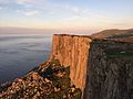
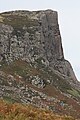
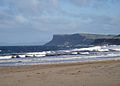
dolerite mountain cliff, Northern Ireland  | |||||
| Upload media | |||||
| Instance of | |||||
|---|---|---|---|---|---|
| Location | County Antrim, Northern Ireland | ||||
| Located in or next to body of water | |||||
| Maintained by | |||||
| Elevation above sea level |
| ||||
 | |||||
Media in category "Fair Head"
The following 77 files are in this category, out of 77 total.
-
 20166715112 54af5d78.jpg 3,264 × 2,448; 2.45 MB
-
 Above Marconi (2083707844).jpg 969 × 468; 436 KB
-
 Admiralty Chart No 2201 North Channel Mull of Kintyre to Belfast Lough, Published 1946.jpg 11,001 × 16,148; 44.88 MB
-
 Admiralty Chart No 46 Ailsa Craig to Bloody Foreland, Published 1861.jpg 20,202 × 11,078; 58.98 MB
-
 Ballycastle beach, September 2010 (01).JPG 4,272 × 2,848; 4.23 MB
-
 Ballycastle from Fair Head, September 2010.JPG 4,272 × 2,848; 4.22 MB
-
 Ballycastle Harbour, September 2010 (10).JPG 2,848 × 4,272; 3.79 MB
-
 Ballycastle sea front - geograph.org.uk - 114896.jpg 640 × 479; 71 KB
-
 Ballycastle waves - geograph.org.uk - 736928.jpg 640 × 420; 68 KB
-
 Boulders - geograph.org.uk - 471118.jpg 640 × 408; 258 KB
-
 Cairn near Coolanlough - geograph.org.uk - 238371.jpg 640 × 427; 65 KB
-
 Carrickmore - geograph.org.uk - 465081.jpg 640 × 403; 259 KB
-
 Cattle grid, Fair Head Lane - geograph.org.uk - 810433.jpg 640 × 480; 123 KB
-
 Clachan at Coolanlough - geograph.org.uk - 238348.jpg 640 × 427; 77 KB
-
 Cliff - Fair Head, Ballycastle, Northern Ireland, UK - August 15, 2017.jpg 4,912 × 7,360; 21.43 MB
-
 Climber in Fair Head.jpg 2,544 × 2,314; 5.78 MB
-
 Coal Seam - geograph.org.uk - 470247.jpg 640 × 427; 277 KB
-
 Colliery Bay - geograph.org.uk - 454043.jpg 640 × 405; 94 KB
-
 Doonmore - geograph.org.uk - 468574.jpg 427 × 640; 271 KB
-
 Fair Head (Ballycastle) Co. Antrim - geograph.org.uk - 185091.jpg 640 × 483; 61 KB
-
 Fair Head (Ballycastle) Co. Antrim - geograph.org.uk - 185095.jpg 640 × 483; 62 KB
-
 Fair Head (Ballycastle) Co. Antrim - geograph.org.uk - 186437.jpg 640 × 483; 47 KB
-
 Fair Head - 4112175855.jpg 3,000 × 2,209; 2.4 MB
-
 Fair Head - Ballycastle, Northern Ireland, UK - August 15, 2017 01.jpg 7,080 × 4,720; 16.4 MB
-
 Fair Head - Ballycastle, Northern Ireland, UK - August 15, 2017 02.jpg 4,912 × 7,360; 24.18 MB
-
 Fair Head - Ballycastle, Northern Ireland, UK - August 15, 2017 03.jpg 7,360 × 4,912; 17.56 MB
-
 Fair Head - Ballycastle, Northern Ireland, UK - August 15, 2017 04.jpg 30,000 × 5,904; 105.44 MB
-
 Fair Head - Ballycastle, Northern Ireland, UK - August 15, 2017.jpg 7,315 × 4,867; 20.61 MB
-
 Fair Head - geograph.org.uk - 465040.jpg 427 × 640; 291 KB
-
 Fair Head - geograph.org.uk - 465051.jpg 640 × 427; 261 KB
-
 Fair Head - geograph.org.uk - 465495.jpg 640 × 427; 273 KB
-
 Fair Head - geograph.org.uk - 468584.jpg 640 × 443; 276 KB
-
 Fair Head - geograph.org.uk - 471163.jpg 640 × 393; 243 KB
-
 Fair Head - geograph.org.uk - 471435.jpg 640 × 419; 249 KB
-
 Fair Head - geograph.org.uk - 817076.jpg 640 × 543; 303 KB
-
 Fair Head by Henry Wallis, steel engraving, c 1842.jpg 800 × 1,039; 189 KB
-
 Fair head from Marconi (2082928107).jpg 954 × 614; 610 KB
-
 Fair Head Lane - geograph.org.uk - 810405.jpg 640 × 480; 169 KB
-
 Fair Head Rock Climbs.jpg 1,057 × 520; 83 KB
-
 Fair Head to Islay (3581343203).jpg 3,567 × 2,132; 886 KB
-
 Fair head, Antrim, N.Ireland.jpg 2,030 × 1,149; 676 KB
-
 Fair Head, Ballyvoy, September 2010 (01).JPG 2,848 × 4,272; 7.75 MB
-
 Fair Head, Ballyvoy, September 2010 (02).JPG 4,272 × 2,848; 5.35 MB
-
 Fair Head, Ballyvoy, September 2010 (03).JPG 4,272 × 2,848; 5.72 MB
-
 Fair Head, Ballyvoy, September 2010 (04).JPG 2,848 × 4,272; 6.2 MB
-
 Fair Head, Ballyvoy, September 2010 (05).JPG 4,272 × 2,848; 4.78 MB
-
 Fair Head, Ballyvoy, September 2010 (06).JPG 4,272 × 2,848; 4.35 MB
-
 Fair Head, Ballyvoy, September 2010 (07).JPG 4,272 × 2,848; 5.52 MB
-
 Fair Head, Ballyvoy, September 2010 (08).JPG 4,272 × 2,848; 5.19 MB
-
 Fair Head, Ballyvoy, September 2010 (09).JPG 2,848 × 4,272; 5.41 MB
-
 Fair Head, Ballyvoy, September 2010 (10).JPG 4,272 × 2,848; 4.78 MB
-
 Fair Head, Ballyvoy, September 2010 (11).JPG 2,848 × 4,272; 4.61 MB
-
 Fair Head, County Antrim (13290601054).jpg 1,340 × 1,008; 485 KB
-
 Fair Head, County Antrim, Ireland.jpg 3,072 × 2,048; 1.61 MB
-
 Fair Head, Ratlhin, Islay (3582157348).jpg 3,500 × 2,484; 982 KB
-
 Fairhead Road, Ballyvoy, September 2010.JPG 4,272 × 2,848; 4.38 MB
-
 Fairhead-Jollyroger.jpg 450 × 600; 72 KB
-
 Fairhead.jpg 2,272 × 1,635; 709 KB
-
 Fireball3.jpg 317 × 470; 97 KB
-
 Glenshesk near Ballycastle (1) - geograph.org.uk - 844345.jpg 640 × 375; 93 KB
-
 Grey Man's Path at Fair Head, Ballycastle, Northern Ireland - NLI.jpg 1,500 × 2,064; 1.42 MB
-
 Grey Mans Path, Fair Head, from Illustrated London News, 1874.jpg 335 × 390; 35 KB
-
-
 Murlough Bay - geograph.org.uk - 471467.jpg 640 × 413; 257 KB
-
 Murlough Bay and Fair Head, Coast of Antrim .PNG 717 × 471; 784 KB
-
 Murlough Bay, County Antrim, September 2010 (06).JPG 4,272 × 2,848; 3.48 MB
-
 Nick Bullock on Complete Scream.jpg 3,968 × 2,976; 10.96 MB
-
 Ordnance Survey One-Inch Sheet 02 North Antrim, Published 1938.jpg 12,940 × 10,196; 10.26 MB
-
 Ordnance Survey One-Inch Sheet 1 North Coast (Northern Ireland), Published 1961.jpg 16,924 × 7,967; 9.96 MB
-
 Photograph of two boys sitting on the rock at Fair Head.jpg 488 × 582; 177 KB
-

-
 Rathlin Island from Bengore Head on the North Antrim Coast.jpg 3,840 × 2,160; 3.6 MB
-
 Rathlin island from Torr Head.jpg 2,048 × 1,536; 696 KB
-
 Round the corner - geograph.org.uk - 339976.jpg 640 × 471; 92 KB
-
 South leg of Rathlin Island looking towards Fear Head.jpg 2,048 × 1,536; 724 KB
-
 Gribbin - geograph.org.uk - 454056.jpg 640 × 411; 108 KB
-
 Gribbin - geograph.org.uk - 470342.jpg 475 × 640; 256 KB

.jpg)


.JPG)

.JPG)


_Co._Antrim_-_geograph.org.uk_-_185091.jpg)
_Co._Antrim_-_geograph.org.uk_-_185095.jpg)
_Co._Antrim_-_geograph.org.uk_-_186437.jpg)


.jpg)


.jpg)

.JPG)
.JPG)
.JPG)
.JPG)
.JPG)
.JPG)
.JPG)
.JPG)
.JPG)
.JPG)
.JPG)
.jpg)

.jpg)


_-_geograph.org.uk_-_844345.jpg)


.JPG)


,_Published_1961.jpg)

.jpg)


